Modelling and data frameworks
Models within SPARCCLE have been widely used for over a decade in EU climate and energy policymaking and quantitative climate impacts assessment (e.g., PRIMES, GEM-E3, GLOBIOM-G4M, IMAGE, supporting DG CLIMA and DG ENER). SPARCCLE brings together a wide range of methodologies and modelling tools, the majority of which are open source, that will be further developed in the project. They will be extensively improved to more consistently include scenarios of climate change impacts (on the energy and land-use sectors, and socioeconomic development), multi-dimensional vulnerabilities, the monetisation of climate impacts, cross-sectoral effects, and adaptation measures.
FaIR
The FaIR model is a flexible reduced-complexity climate model designed to produce probabilistic projections of global mean surface temperature (and other variables) given input emissions, greenhouse gas concentrations or radiative forcing, in a fraction of a second. It includes simplified representations of the uptake of emitted CO2, methane atmospheric chemistry, aerosols, ozone and land use change calibrated on Earth System Models and constrained to the latest climate observations.
MESMER
MESMER is a spatially-resolved climate emulator that replicates the behaviours of Earth system models to emulate their variables at a lower computational cost. This model may be used to replicate the spatial and temporal evolution for new warming pathways, accounting for natural variability, thus it is of high interest for impact assessment. It is currently designed to emulate surface temperatures: annual mean, monthly mean, and annual maximum; soil moisture; and fire weather. MESMER is developed on GitHub. Over the course of the project SPARCCLE, MESMER will be extended to other climate extreme and hazard indicators. It will be used to emulate such variables under projected emissions scenarios, such as the new climate mitigation/adaptation scenarios planned in WP5.
CTSM
CTSM (Community Terrestrial Systems Model) is a flexible land surface model designed to simulate terrestrial processes, including energy, water, carbon, and nutrient cycles, and is developed as the land component of the Community Earth System Model (CESM). Its broad capabilities make it a valuable tool for assessing integrated climate impacts by providing important data for understanding the comprehensive effects of climate change on ecosystems and human systems (including metrics of heat stress, runoff, and crop yield). As part of WP2, climate impact data from CTSM simulations conducted as part of the ISIMIP (Inter-Sectoral Impact Model Intercomparison Project) initiative will be used to calibrate MESMER, enabling the probabilistic emulation of climate impacts. This integration supports detailed assessments of climate hazards and extremes, contributing to the development of mitigation and adaptation strategies in subsequent WPs.
ISIMIP
The Inter-Sectoral Impact Model Intercomparison Project (ISIMIP) offers a framework for consistently projecting the impacts of climate change across affected sectors and spatial scales. An international network of climate-impact modellers contributes to a comprehensive and consistent picture of the world under different climate-change scenarios. ISIMIP data is used extensively within the project.
WIC projections
The WIC population projection model uses a multi-dimensional cohort-component approach. It was developed by the IIASA Population and Just Societies (POPJUS) Programme in the 1980s and was implemented to conduct global population projections by education in 2014, following the five Share Socioeconomic Pathways (SSP) scenarios.
CLIMADA
Using state-of-the-art probabilistic modelling, CLIMADA allows the estimation of the expected socio-economic and ecological impacts resulting from extreme weather events as a measure of risk today, the incremental increase from socio-economic growth and ecological evolution, and the further increase due to climate change. The model is well suited to provide an open and independent view on physical risk at any scale and on any temporal resolution.
CATSIM
The CatSim (Catastrophe Simulation) Model has been designed to help policymakers and advisors devise public financing strategies for understanding catastrophic risks from natural hazards and identifying options to enhance their country’s financial resilience. National and regional data can be input into CatSim allowing policy advisers to pose “what if” questions. The model and relevant stakeholder exercises can identify best and appropriate combinations of financial risk management strategies to suit national circumstances.
IMAGE
IMAGE is an integrated assessment modeling framework that simulates the environmental consequences of human activities worldwide. It represents interactions between society, the biosphere and the climate system to assess sustainability issues such as climate change, biodiversity and human well-being. The model can be used to explore the long-term pathways for future environmental and sustainable development problems as well as possible response strategies. The model has a detailed representation of the global energy and land systems, including supply and demand of relevant resources and end-products, nutrient and water flows, and interactions therein.
MESSAGEix
MESSAGEix is a versatile, dynamic systems-optimisation modelling framework developed by the IIASA Energy, Climate, and Environment (ECE) Programme since the 1980s. It is used for medium to long-term energy system planning, energy policy analysis, and scenario development.
PRIMES
GLOBIOM-G4M
GLOBIOM/G4M consists of two interlinked models, GLOBIOM and G4M. The Global Biosphere Management Model (GLOBIOM) is a global recursive dynamic partial equilibrium model of the forest and agricultural sectors. The model is based on a bottom-up approach where the supply side of the model is built-up from the bottom (land cover, land use, management systems) to the top (production/markets). The agricultural and forest productivity is modelled spatially explicit through links to biophysical models (crop models, forest growth models, etc.) for different production systems. G4M is a forest sector model and estimates the impact of forestry activities (afforestation, deforestation, residue harvest and forest management) on biomass and carbon stocks. The model incorporates empirical forest growth functions for major tree species groups and is spatially explicit. G4M relies on information for wood prices, land rents and wood demand from GLOBIOM. GLOBIOM/G4M together cover all UNFCCC land use categories of relevance for CO2 emissions.
GEM-E3
The GEM-E3 model is a multi-regional, multi-sectoral, recursive dynamic computable general equilibrium (CGE) model which provides details on the macro-economy and its interaction with the environment and the energy system. It is an empirical, large scale model, written entirely in structural form. GEM-E3 allows for a consistent comparative analysis of policy scenarios since it ensures that in all scenarios, the economic system remains in general equilibrium. In addition, it incorporates micro-economic mechanisms and institutional features within a consistent macro-economic framework and avoids the representation of behaviour in reduced form. Particularly valuable are the insights the model provides regarding the distributional aspects of long-term structural adjustments. The GEM-E3 model is extensively used as a tool of policy analysis and impact assessment.
d-PLACE
D-PLACE is a recursive dynamic, global, multi-sector Computable General Equilibrium (CGE) model, based on GTAP (Global Trade Analysis Project) dataset. In a current setting, the model distinguishes 20 industries/commodities (including energy intensive and trade exposed industries, such as production of refined oil products and coke, chemicals, non-metallic mineral products, paper and pulp, iron and steel, and non-ferrous metals), and 19 regions (country groups or individual countries), including 9 EU regions, and 10 non-EU regions. In its core, d-PLACE follows standard formulations, with nested Leontief-CES (Constant Elasticity of Substitution) production functions, marginal cost pricing and bilateral trade based on the Armington assumption. The model contains detailed information on GHG emission structure and implements emission reduction targets in the EU ETS (European Union Emissions Trading System), as well as separate country-level targets for the non-ETS sectors in the EU. Emission pricing is used as an instrument to facilitate emission reductions. The model includes a few explicit technologies of emission abatement, including hydrogen and CCS. Emission abatement in energy, agriculture and transport model is calibrated with the output of sectoral models.
RICE50+
RICE50+ is a multi-regional Integrated Assessment Model for Assessment and Cost-Benefit Analyses based on calibrated mitigation and climate impact costs for over 50 regions and countries. The model is a modular, highly regionalised, and flexible model built upon the DICE model, with calibrated abaetment costs, a variety of regional climate and impact functions. It includes in a modular fashion features such as within-country inequality, Solar Radiation Management, Carbon Dioxide Removal, and Natural Capital, among others. The modeling framework considers 57 (and up to 160) independent countries/regions. The dynamics of economic growth, greenhouse gases (GHG) emissions, emissions mitigation costs, and economic impacts due to climate change follow the well-known integrated assessment model DICE. The regional representation is consistent with the finest granularity at which data, especially marginal abatement costs curves (MACC), is available. Socioeconomic drivers, including population and economics growth at the country level, come from the five Shared Socioeconomic Pathways (SSP).
MIMOSA
MIMOSA is an open-source cost-benefit Integrated Assessment Model. It uses a Cobb-Douglas production function and has baseline emissions, total factor productivity and population calibrated on the Shared Socio-Economic Pathways (SSPs). Mitigation occurs through a Marginal Abatement Cost (MAC) curve, which has been calibrated to reproduce the mitigation costs from the IPCC 6th Assessment Report WGIII scenario database. Each region uses the same global Marginal Abatement Cost (MAC) curve, but with a region-specific scaling factor calibrated using SSP2 MAC curves from the IMAGE model. This scaling factor is obtained by comparing the carbon price per region required to reach 75% CO2 reduction in 2050 compared to baseline, relative to the world average. The regional differences in marginal abatement costs stay constant over time: a region that has relatively cheap mitigation options now is assumed to keep relatively cheap marginal mitigation costs throughout the century.
Datasets and software
Scientific publications and datasets can be found at our ZENODO COMMUNITY.
Models will be hosted on GitHub.
Data explorers and tools

SPARCCLE-Explorer
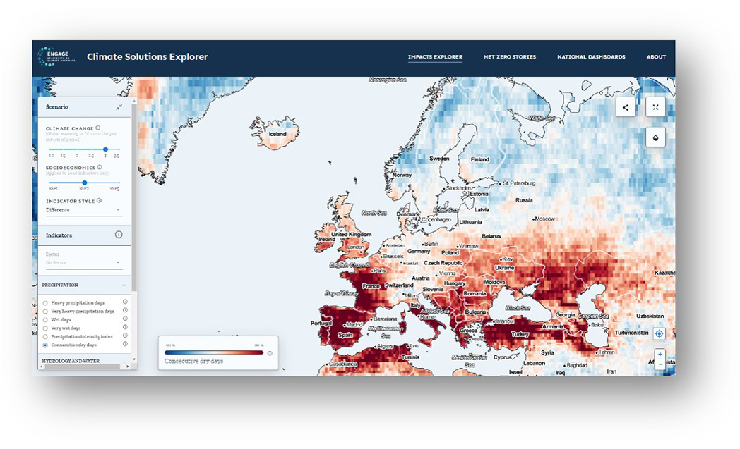
High-resolution projections of socioeconomics & climate risk for Europe
(in development)

EU Scoreboard
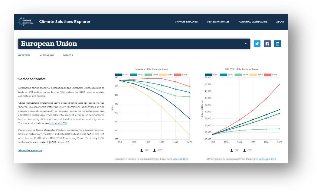
Interactive dashboards for European countries & cross-country comparison
(in development)